UN
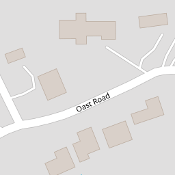
12a Oast Road
£ 515,000
Description
We don't have a Description for this property.
- Bedrooms
- 5
- Bathrooms
- 0

Leaflet © OpenStreetMap contributors
The heatmap indicates the level of crime in the area. The color of the heatmap indicates the crime severity and recency.
Metrics Year-on-Year
- Average area value
- 542,500.00 £Decreased by 12.79 %
- Average area rental value
- 4,600.00 £/moIncreased by 88.60 %
- Est rental Yield
- 10.18 %Increased by 116.14 %
- Crime Rate
- 1.00 %Unchanged by 0.00 %
from 622,061.00 £
from 2,439.00 £/mo
from 4.71 %
from 1.00 %
Nearby Schools
| Name | Type | Ofsted | Distance |
|---|---|---|---|
| Moor House School & College | Non-maintained Special School | Outstanding | 0.52 KM |
| Hurst Green Infant School | Community School | Good | 1.02 KM |
| Hurst Green & Holland Sure Start Children'S Centre | Children's Centre | 1.02 KM | |
| Hazelwood School | Other Independent School | 1.10 KM | |
| Oxted School | Academy Converter | Requires improvement | 1.51 KM |
Images
Nearby Streets
| Name | Average Price | Average Sqft | Distance |
|---|---|---|---|
| Laurel Drive | £ 0 | 0 | 0.00 KM |
| Parklands | £ 0 | 0 | 0.00 KM |
| Johnsdale | £ 535,000 | 0 | 0.00 KM |
| Broom Hill | £ 0 | 0 | 0.00 KM |
| Station Approach | £ 0 | 0 | 0.00 KM |
Nearby Transport
| Name | NLC | TLC | Distance |
|---|---|---|---|
| Hurst Green | 5463 | HUR | 0.57 KM |
| Oxted | 5377 | OXT | 1.33 KM |
| Godstone | 5474 | GDN | 6.32 KM |
| Woldingham | 5440 | WOH | 7.45 KM |
| Lingfield | 5369 | LFD | 7.85 KM |
Nearby Listings
| Address | Price | Type | Score | Distance |
|---|---|---|---|---|
| Laurel Drive, Oxted, RH8 | £ 1,600,000 | BUY | Unknown | 0.13 KM |
| Oast Road, Oxted, Surrey, RH8 | £ 1,550,000 | BUY | 7 / 10 | 0.22 KM |
| Church Way, Oxted, RH8 9EA | £ 1,425,000 | BUY | Unknown | 0.23 KM |
| Hurst Green Road, Oxted | £ 800,000 | BUY | 7 / 10 | 0.26 KM |
| Parklands, Oxted, Surrey, RH8 | £ 1,595,000 | BUY | 8 / 10 | 0.33 KM |
Nearby Properties
| Address | Price | Distance |
|---|---|---|
| 12a Oast Road | £ 515,000 | 0.00 KM |
| 3a Oast Road | £ 950,000 | 0.00 KM |
| 7 Oast Road | £ 785,000 | 0.00 KM |
| 4 Oast Road | £ 1,300,000 | 0.00 KM |
| 10 Oast Road | £ 775,000 | 0.00 KM |